Category Archives: Hydrauilics

Reservoir vs Dams || Reservoir- Types and functions

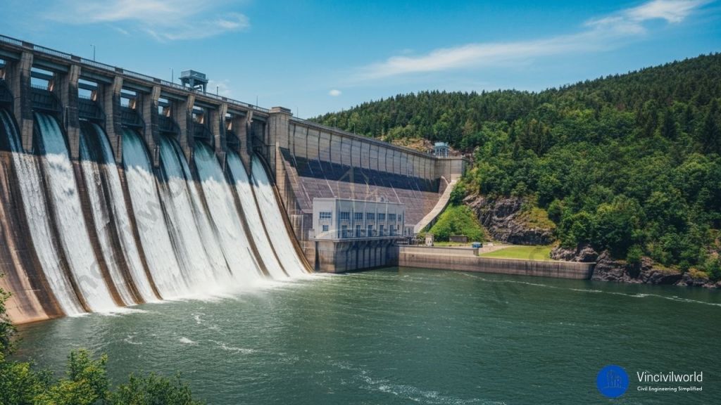
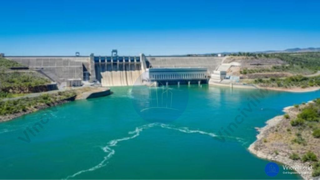
Reservoirs are artificial or natural structures used for collecting and storing for further usages. The reservoir is formed by constructing dams across rivers, valleys, and streams. The Reservoir is located on the upstream side of dams and prevents floods by managing the water flow apart from serving as a storage basin.

Also Read : Types of Dams – 3 Classification Criteria Explained.

Also Read : Components of a bridge – Types and Functions Explained

Functions of Reservoirs

Reservoirs are man made lake or a fresh water body that plays an important role a lot of ways as listed below.

  • Water supply
  • Flood control
  • Environmental management
  • Hydroelectric power management
  • Navigation
  • Irrigation
  • Development of fish and wildlife
  • Soil conservation
Reservoir behind dam

Also Read : Components of a dams-12 Dam Components explained.

Types of reservoirs

Reservoirs are broadly classified into three types.

  • Valley dammed reservoirs
  • Back-side reservoirs
  • Service reservoirs

Valley dammed reservoirs

Valley dammed reservoirs are located between mountain valleys where there is an existing water body. A dam is built in the narrowest portion for holding the water.

Bank-side reservoirs

Bank side reservoirs are made by diverting water from rivers and streams to an existing reservoir. These reservoirs can be located in different geographical locations.

Service reservoirs

Service reservoirs are man made reservoirs located above the ground or below the ground. The huge water towers/ water tanks and sumps are service reservoirs.

Service Reservoir
Service reservoir

Reservoir components and terms

There are some specific terms for defining the water level and storage capacity of a reservoir

Pool level

The water level at a particular point of time is called the pool level. No water can be collected above the maximum pool level. No water can be drained below the minimum pool level.

Useful Storage

The volume of water within the normal pool level and minimum pool level is known as useful storage.

Dead storage

The volume of water underneath the minimum pool level is known as dead storage.

Surcharge Storage

The volume of water within the normal pool level and maximum pool level is known as surcharge storage.

Reservoir yield

The volume of water discharged within a certain interval of time is reservoir yield.

Reservoir Planning

Accurate planning is necessary for locating a reservoir. For planning a reservoir the following points are taken into consideration.

Topography

A Broad natural valley opts as the site of a reservoirs. The valley can be U- shaped or V-shaped. For reservoirs sites, flatland and plains are not considered.

Ground water condition

The groundwater investigation is done by analysing the water table level and reservoir level.Hence it is an ideal situation for the reservoirs site if the water table level and the top reservoir level is the same. No loss or gain is ensured.

Permeability

Permeability is a default nature as the rocks are porous. It is considered when the water table is below the reservoirs level. It is a significant characteristic for investigation.

Hydrological Investigation

This involves the study of runoff pattern. Leakage quantity should be minimum. Storage capacity calculation and maximum discharge rate are also estimated.

Difference between dams and reservoirs

DAMSRESERVOIR
Structural barriers built across,rivers
valleys,streams etc for the purpose of
storing and managing water flow.
Reservoir is a large water body formed behind the constructed dam structure across a river,stream,etc
Dams are reinforced concrete structures or structures made of bricks rubble etc erected across water bodies to control the water flow.The reservoir is the water that accumulates behind the constructed dam.
Create site for hydro electric power generation. This can improve the industrial development and living standards of people living in that region.Stores water for later usage, water for human consumption and excess water for agricultural and industrial uses.
Dams fluctuates oxygen levels and restricts migration of fishes in the river.Reservoirs leads to the displacement of people.
Dams are tourist attraction sitesHelps in water transportation

Reservoir Sedimentation

Rivers transport sediments. During heavy rainfall, sediments are carried by the water to the reservoir. Silts are accumulated due to soil erosion. These get collected in the dead storage.
Sedimentation depends on Rainfall intensity, Soil nature, Soil type, topography and vegetation. The sediment deposit replaces the water storage. Thus water supply and flood control are affected.
The sediments should be removed eventually. Hydraulic flushing, dredging, Explosive mobilization are methods adopted for sedimentation removal.

Reservoir
reservoir

Environmental impacts of Reservoirs.

  • The construction of the reservoir prompts severe effects on the environment.
  • Since the water is stored, the rate of transpiration is high. This changes the moisture concentration.The climate of the surrounding area is affected. It causes natural temperature fluctuation. This causes heavy rainfall and deprives the traditional rainfall patterns.
  • Reservoirs disturb the flow and composition of the rivers. The water from the downstream has high energy, it enhances the water flow by eroding the river bed.
  • The change in the river composition affects the upstream and downstream habitats. The reservoirs disturb the fish and birds migration.
  • Studies show that reservoirs emit greenhouse gases. Anaerobic bacterias are seen in the river bed releases carbon dioxide and methane. This occurs in tropical regions.
  • They also cause troubles for people living near the reservoir site. Old and failing dams lead to disasters.
  • Reservoir induced seismicity is a phenomenon of provoking earthquake by reservoirs. This happens when water sweeps into the minor cracks under the bed.

Dams – Site selection, Advantages and Disadvantages

Site selection for dams is a critical process that ensures the structure’s stability and efficiency. Choosing the right location is essential for minimizing risks and maximizing the dam’s performance. Geology, river flow, and environmental impact are crucial factors. They play a key role in determining the best site selection of a dam. A well-placed dam offers significant advantages, such as water storage and flood control, while improper sites increase the disadvantages of dams, like ecological damage and costly maintenance. Balancing these factors is vital for success.

Dams are obstructions constructed across the water bodies to control the water flow and water levels. Dams serve as a water source for human consumption, irrigation purpose, and power generation. They also help prevent floods when there is a sudden discharge of floodwater. The water that impounds in the dams is also used for recreation purposes and industrial uses. They are mostly made up of rock fill or earthen.

  1. What are dams?
  2. Benefits of dam
  3. Site selection of dams.
  4. Advantages of dams
  5. Disadvantages of Dams
  6. Key Takeaways
  7. Conclusion

What are dams?

The dams are barriers built to restrict and manage the natural flow of rivers, waterways, or streams for human needs. A dam may be a natural one or artificial. They help to confine water and reduces the water rise and flood problems. Dams retain water by forming a reservoir behind the structure. They got an Upstream side and Down stream side. The place where water is collected is called the Upstream side. The water impounded is used as storage and is called Reservoir.

Dams
site selection for dams
Site selection for dams

Also read : Type of Dams – 3 main classification criteria explained

Benefits of dam

The dams provide a range of environmental, economic and social benefits

One of the most important benefits of dams is water storage. The stored water is used for drinking, cleaning, bathing, gardening, irrigation purposes, industrial purposes.

The large dams and reservoirs serve as recreational spots for fishing and boating purposes. Dams play a major role in preventing damages due to floods by collecting and storing excess water during rains and are released as and when required.

The dam is the main source of providing water for irrigation purposes in areas where rain and water are scarce.

Also read : Methods of irrigation – 3 methods full guide

Site selection of dams.

The dam is a massive and strategic structure and needs a perfect site selection before proceeding with construction.Site selection of dams involves assessing factors like geology, river flow, and environmental impact. These factors ensure structural stability and reduce ecological disruption. The right site selection for dams minimizes risks such as flooding and maintenance issues. Soil type, valley shape, and climate also play a key role in site viability.

  • Topography -Making maximum use of the available volume of water is the main objective of a dam. The slope of the area, groundwater table, contour, weather condition, etc is other factors for dam site selection. The bed level at the dam site should preferably be higher than that of the river basin. This is for reducing the dam height and facilitating the drainage of water.
  • Foundation – The foundation should bear the whole weight and pressure of the dam. It should be permeable, thick, and should have adequate strength.
  • Economic criteria – This includes the construction and maintenance cost of the dam. The land value, cost of construction materials and construction time, etc. to be taken into account while selecting a dam site. Quality construction materials required for dam construction have to be available near the proposed location. Always opt for a small length dam with maximum water holding capacity for economising the project. 
  • Height of Dam – The height of the dam should be economical, and should store the maximum amount of water.
  • Earthquake zone – The dam site should not be an earthquake zone. It may cause a collapse of the dam and losses. 
  • Material availability – Materials like rock, aggregate, soil, filler, etc. should be available near the site.
  • Climate condition – The climate of the site should be bearable, possibilities of landslides should not occur.
  • Spillway site: A suitable location for the spillway should be available in the nearby vicinity of the dam. 
  • The dam site should be easily accessible and economically connected to nearby areas. Area required for establishments and labour camps of construction group shall be available nearby in a safe zone.
  • Environmental issues should be taken into consideration while selecting the dam site.
Dam with sluice gate
Dam site selection

Advantages of dams

  • Water storage : Dams are one of the major sources of water for domestic uses. These uses include cooking, cleaning, bathing, washing, drinking water, and gardening. They also provide water for agricultural and industrial purposes. The water is supplied through the canal or with the help of a pipe system from the dam.
  • Irrigation – The water from the dams is diverted through canals. This water reaches fields where the water level is low. It is used for irrigation purposes.
  • Hydroelectric power – The water stored in the dam is passed through turbines for hydroelectric power generation.
  • Flood prevention – The water level of river, streams, etc are maintained by constructing dams across it. This prevents the loss and damages from unexpected floods. 
  • Recreation – The water stored in the dam is used for fishing, boating, and other recreational activities.
  • Debris control – Dam also provides the retention of hazardous material and protects the environment.

Disadvantages of Dams

  • Groundwater table – Stagnation of water in the dams alters the groundwater table.
  • Ecosystem – The dams prevent the fish migration and help in the breeding of mosquito which affects the ecosystem.
  • Water temperature – The aquatic temperature is varied by the dams, which causes a serious problem for aquatic lives.
  • Greenhouse effect – The reservoirs emit greenhouse gases which leads to global warming.
  • Rehabilitation – The discharge of water from the river affects the peoples living in the downstream area.

Key Takeaways

  • Importance of Site Selection: Effective dam construction relies on careful site selection, considering hydrological and geological factors.
  • Advantages of Dams:
    • Provide water storage for irrigation and drinking.
    • Offer flood control and management.
    • Generate hydroelectric power, contributing to energy supply.
  • Disadvantages of Dams:
    • Can lead to environmental degradation and loss of biodiversity.
    • May displace local communities and affect livelihoods.
    • Alter aquatic ecosystems and sediment transport.
  • Mitigation Strategies: Comprehensive environmental assessments and proper planning can help address negative impacts.
  • Stakeholder Engagement: Involving local communities in the decision-making process enhances public acceptance and addresses concerns.
  • Balanced Decision-Making: Understanding both advantages and disadvantages of dams is vital for informed policy and engineering choices.
  • Sustainable Practices: Prioritizing sustainability in dam projects ensures long-term benefits for both society and the environment.

Conclusion

The process of dams site selection requires careful consideration of various factors. It involves balancing the advantages of water management and energy generation. These must be weighed against the disadvantages related to environmental and social impacts. By prioritizing sustainable practices and involving communities in decision-making, the negative consequences of dams can be minimized. Policymakers and engineers must adopt an integrated approach to site selection for dams. This approach ensures the benefits provided align with ecological preservation. It also supports social equity. A well-informed strategy will help develop dams that positively impact society. It will also protect natural resources for future generations.

Controlled Flooding- 6 Types| Free Flooding| Basin Flooding

Types of flooding is an important topic in irrigation engineering, but they are usually classified based on the irrigation method rather than flooding itself. It’s mainly divided into three. Surface irrigation where water flows directly over the soil including basin flooding, furrow and border techniques.In subsurface irrigation water is delivered below the soil surface via tubes, minimizing evaporation. In case of sprinkler irrigation pipes and sprinklers are used to distribute water like rainfall.

In this blog, we will delve deep into the different types of controlled flooding in irrigation, exploring methods such as Free flooding, basin flooding, flooding by contour laterals, zigzag method of flooding, border strip flooding and check flooding are the 6 types of controlled flooding which is a subcategory of surface irrigation.

We will examine how these techniques manage water efficiently, their advantages, and their impact on agriculture and the environment.

What is Controlled Flooding Method of Irrigation

In controlled flooding, water is spread or flooded on a rather smooth flat land, without much control or prior preparation. This method is generally used in the inundation irrigation system in which water is forced to spread over vast tracts during the season of high streamflow.

It is a wasteful use of water and is practised largely where irrigation water is abundant and inexpensive.

Controlled flooding techniques in irrigation, including the flooding method of irrigation, optimize water use and minimize damage. Unlike traditional flooding irrigation, which can lead to inefficient water use, controlled flooding carefully manages water levels to enhance efficiency. Techniques such as free flooding, where water spreads broadly, and wild flooding, which lacks control, are contrasted with more precise methods like the check basin method. The check basin method uses barriers to contain and direct water, reducing runoff and erosion. Controlled flooding not only improves water distribution but also conserves resources and enhances crop yields. By managing water flow more effectively, these techniques address the challenges of traditional flooding, ensuring better agricultural outcomes and environmental sustainability.

Types of Controlled Flooding Irrigation


Controlled flooding irrigation includes several methods to manage water levels efficiently. These techniques aim to improve water distribution and reduce waste. let’s peep into the hierarchy of methods of controlled irrigation.

  • Free Flooding irrigation/wild flooding irrigation
  • Contour Lateral Flooding
  • Border Strips Flooding irrigation
  • Checks basin Flooding
  • Basin Flooding
  • Zigzag Method of Flooding

Free flooding or flooding from field channels

Free Flooding

Free flooding method consists of dividing the entire land to be irrigated into small strips by a number of field channels known as laterals.

  • These laterals may be either at right angles to the sides of the field, or at right angles to the contour lines as shown in figures.
  • When the laterals are aligned at right angles to the sides of the lateral, irrigation is possible only to one side of the lateral. However, when the laterals are aligned at right angles to the contours, irrigation is done to both the sides of the lateral.
  • The field channels receive water from the supply channel and discharge excess water in the waste channel.
  • Water is applied to the strip of a land through feeding points provided at some interval along the laterals.
  • This method of water application can be used both for flat lands as well as for relatively steep lands. The alignment and spacing of the laterals depends upon the type of soil and topography of land.
  • If the slopes are steeper, the closer spacing of laterals is required. Similarly, closer spacing is required for relatively more permeable soils.
  • For flat land and for relatively less pervious soils, the spacing of the laterals may be increased. Normally the spacing of the laterals may vary from 10 to 50 metres.
  • However, the method is more suited for irrigation fields containing medium type soil and having slopes ranging from 1 in 100 to 1 in 300.

Let’s find out about the next method of controlled flooding.

Flooding by contour laterals

Flooding by Contour Laterals

This is a special case of free flooding in which the field channels or laterals are aligned approximately along the contour lines.

This method is applicable to steeper terrain.

The field is cut by a relatively dense network of small contour laterals, the spacing of which depends upon the prominent grade of field between two adjacent ditches or laterals, the uniformity of slope and the soil type.

I have explained the details of border strip flooding and checks basin flooding in previous blogs. So, let’s move on to the next member.

ALSO READ: Rainwater Harvesting Methods: Everything You Need To Know

Border Strips Flooding irrigation

The border strip method, also known as border strip flooding irrigation, involves dividing a field into strips, typically 10 to 20 meters wide and 100 to 300 meters long, separated by low levees or borders. Water is directed from a supply ditch to the head of each strip, flowing down the slope in a controlled sheet, guided by the borders. The surface between the borders is kept level to ensure uniform coverage. Slopes vary from 0.2% to 0.8% along the strip, with cross slopes minimized to prevent uneven irrigation. This method is efficient for forage crops and requires minimal investment and labor. The length of each strip is adjusted based on soil type, infiltration rate, and irrigation stream size. For example, sandy soils typically use shorter strips, while clay soils may use longer ones.

Basin Flooding

Basin Flooding
Basin Flooding

The ring basin flooding is a special form of check basin flooding adapted to orchards.

  • Ring basins are formed for each tree; in some cases, one ring basin may be formed for two or more trees.
  • Water is supplied to these basins through a supply ditch. In some cases, a number of ring basins are interconnected.
  • Portable pipes or large hoses may also be used in place of ditches.

Last, but not the least let me explain about final method of controlled flooding.

Zigzag method of controlled flooding

Zig Zag Method of Flooding

It is special method of flooding where water takes circuitous route before reaching the dead end of each plot.

  • The whole area is divided into a number of square or rectangular plots; each plot is then subdivided with the help of low bunds or levees.
  • This method is suitable for relatively level plots. It is, however, highly unsuitable for farming operations with modern farm machinery.

That’s it about the methods of controlled flooding.

MUST-READ: Concept of green building- 4 comprehensive concepts easy read!

I hope you got a fair idea about free flooding, basin flooding, flooding by contour laterals and zigzag method of flooding.

Happy learning!

Check flooding and Border strip methods of irrigation| Types of surface irrigation

Check flooding and border strip method are two types in surface irrigation, one of the major methods of irrigation. In the blog, we are going to learn everything about these two with figures.

Before we begin, let’s look at the classification of surface irrigation. Check flooding and border strip method are two that comes in the bottom. I will surely cover other main categories in another blog.

We saw the hierarchy of methods of surface irrigation. Let’s jump right into the first method which is border strip method.

Figure shows methods of irrigation

Border strip method in detail

The diagram below shows border strip method.

Figure shows border strip method
Diagram showing border strip method

Border strip method is otherwise called border strip flooding method. The main points regarding this are,

In the border strip flooding method, the farm is divided into a series of strips 10 to 20 metres wide and 100 to 300 metres long.

These strips are separated by low levees or borders and run down the predominant or any other desired slope.

To irrigate, water is turned from the supply ditch onto the head of the border. Water advances confined and guided by two borders in a thin sheet towards the lower end of the strip.

The surface is essentially level between two borders so that the advancing sheet of water covers the entire width of the strip.

The lengthwise slope varies from 0.2 to 0.8 %. The border strip should be level cross wise.

Cross slopes within border strips cause water to concentrate along the lower side of the strip causing uneven irrigation.

This method is especially suited to forage crops,its advantage being that for a relatively low investment a system can be developed which can afford the highest irrigation efficiency and lowest labour requirements.

With highly mechanised farming, large area can be irrigated within a short time by border strip method. The length of border strip depends upon how quickly it can be wetted over its entire length. This depends upon,

  • Infiltration rate of the soil
  • Longitudinal slope of the land
  • Size of irrigation stream available

The following lengths are suggested for moderate condition

Type of soil of border stripLength
Sandy soil or sandy loam   60- 90m
Medium silt loam90-150
Clay loam or clay soil  150- 300
Length of border strip with type of soil

The first 6 to 12m length of the strip should be made level to ensure uniform spreading of water. Water is diverted to the border strips from the following

Warth or concrete ditches

These run at a flat longitudinal grade. The water is discharged into the strips via border gates, aluminum syphons or plastic piping

Underground concrete pipes through risers

In this method, water is let into the strips by concrete risers

That’s it about border strip method. Let me walk you through check flooding now.

Also read: Concept of Green Building- 4 comprehensive concepts easy read!

Check flooding

The diagram given below shows check flooding.

Figure shows check flooding
Check flooding

The method is also known as irrigation by plots since the entire area is divided into several plots obtained by subdividing the entire area by levees

Moving on to the main details,

  • Check flooding is similar to free flooding except that the water is controlled by surrounding the check area with low, flat levees surrounding each check while in free flooding no such levees are provided and the strips are divided by field channels.
  • Each plot is practically level. The size of levee depends upon the depth of water to be applies as well as the stability of the soil when it is wet.
  • Water is conveyed to the land by a system of supply channels a swell as laterals.
  • Usually, there is one field channel for every two rows of plots. Water is admitted to these plots at the higher end and the supply is cutoff as soon as the lower part of the plot has received the sufficient depth of water.
  • Oblong plots are preferred to the square plots. The size of the plots depends on the porosity of the soil.
  • In a levelled ground, the plots are generally rectangular, but if the ground has same initial slope, the checks or levees may follow contours.
  • Contour checks are prepared by constructing ridges along contours at vertical intervals of 6 to 12 cm and connecting them with cross ridges at intervals.
  • Very little crop land is perfectly level, and the water does not stand at a uniform depth over the entire check. This results in uneven distribution of water within the plot.
  • Low area will receive too much water and high gets too little. 
  • The size of check basins is dependent on the infiltration rate. It may vary from 1m2 for growing vegetables and other intensive irrigation to 1- 2 hectares for growing rice under wet land conditions.
  • However, the more common size varies from 0.03 to 0.06 hectares for medium soils. The size of stream should be sufficient to cover the entire basin in a relatively small portion of time required

So, that was the main details on check flooding.

Also read: Innovative Water Conservation Methods Unlocked.

What are your thoughts on border strip method and check flooding? Let me know that in the comments.

Methods of Irrigation- 3 Methods Full Guide

Methods of irrigation is an important portion in hydraulics. There are mainly three methods- surface irrigation, subsurface irrigation and sprinkler irrigation. Subsurface irrigation is again divided into natural sub-irrigation and artificial sub-irrigation.

Before selecting a particular method, the irrigation engineer must evaluate all the factors, and choose that method which is best suited to the local conditions.

Basic requirements for adaptation of irrigation methods

  • The method should be such that uniform water distribution with as small as 6cm water depth applications can be made for light irrigation
  • At the same time, it should afford a heavy uniform application of 15 to 20 cm water depth.
  • It should allow the use of large concentrated water flows for reduction of conveyance losses, and labour cost.
  • It should be suitable for use with economical conveyance structure.
  • It should be such that mechanized farming is facilitated

Good irrigation method results in increased yield and conservation of resources with soil productivity maintained and water utilised economically. Over irrigation results in soil erosion, leached fertilizers, drainage troubles and salt accumulation.

Basic methods of Irrigation

Water may be applied to the crops by through three basic methods of irrigation.

  • Surface irrigation method
  • Subsurface irrigation method
  • Sprinkler irrigation method

Let’s dive into through each of them now.

Also read: Concept of Green Building- 4 comprehensive concepts easy read!

Surface irrigation method- Largest among methods of irrigation

Surface irrigation is a method of irrigation where water is applied and distributed over the soil surface due to gravity. It is the most common form of irrigation throughout the world and has been practised in many areas.

Surface irrigation is also known as flood irrigation, which means that water distribution is uncontrolled. So, it will be inefficient. Some of the irrigation practices grouped under this name involve a large degree of management. Surface irrigation is mainly of three types.

  1. Flooding method
  2. Furrow method
  3. Contour farming
Surface Irrigation classification

We shall discuss about each of the subdivisions in another blog. Now, come with me to shake hands with subsurface irrigation.

Subsurface irrigation method

The sub surface irrigation method consists of  supplying water firectly to the root zone of the crop. The favourable conditions for the sub surfacr irrigation practice are

  1. Impervious sub soil at reasonable depth (2 to 3m) or existence of high water table
  2. Permeable soil such as loam or sandy loam in the root zone of the soil
  3. Uniform topographic conditions
  4. Moderate slopes
  5. Good quality irrigation water

If all these favourable conditions are fulfilled and if proper precautions are taken to prevent alkali accumulation or excess water logging, the method results in exonomical use of water, high crop yield and low labour cost in preparing the irrigation plots.

Subsurface irrigation may be of two classes

  1. Naural sub irrigation
  2. Artificial sub irrigation
Sub surface Irrigation classification

Also read: LEED certification India- a comprehensive guide

Next, let’s know more details about these methods of irrigation shown in the diagram.

1. Natural sub irrigation

In natural sub irrigation, water is supplied to the root zone of the plants by controlling the level of local water table, such a high level of water table in the area may be available due to water seeping from earthen canals, drains, rivers, etc.

The main points in natural sub irrigation are,

  • In order to ensure the requisite supply of water to the root zone, its is essential to maintain the desired water level by artificial means.
  • For this purpose, water is supplied to a series of ditches half to one metre deep and 25 to 50cm wide having vertical sides.
  • These ditches are spaced from 15 to 100m apart depending upon the Permeability_of_sub soil and topography of land.
  • The depth of ditches may vary from 0.3 to 0.5m These channels have relatively flat slopes.
  • Water flows at a slow rate and seeps into the ground to maintain the water table at a height such that water from the capiliary fringe is available to the vrops.
  • Proper drainage of excess water is permitted, either naturally or with the other drainage works to prevent water logging of the fields.
  • Sometimes the upward capiliary water flow from shallow water table may produce saline and alkali conditions and may make the land less productive.
  • Under such circumstances, the subsurface irrigation method has to be discontinued and irrigation has to be resorted by sprinkling method.

Next member is artificial sub irrigation method. What are we waiting for? Let me give you more details on that.

2. Artificial sub irrigation

The artificial sub irrigation method consists of supplying water diretly to the root zone of crops through a network of buried perforated pipes. Water is made to pass under pressure, through these underground perforated pipes.

This method is suitable only for those soils formations which have high horizontal permeability to permit free lateral movement though the root zone of the crops and low vertical permeability so that deep percolation losses are minimised.

The pipe are buried 0.3 to 0.4m deep, so that cultivation operations are not hindered, an are spaced  0.4 to 0.5m horizontally, for uniform distribution of water.

Also read: Vastu for home plan- all design tips backed by logic

Its time to meet the last member, sprinkler irrigation.

Sprinkler irrigation

figure shows sprinkler irrigation
Sprinkler Irrigation

The sprinkler irrigation method consists of applying the water in the form of a spray, somewhat as in ordinary rain, as is done in the garden lawn sprinkling.

The greatest advantage of sprinkler irrigation is its adaptabilities to use under conditions where surface irrigatin methods are not efficient. The method is more useful where,

  1. The land cannot be prepared for surface methods
  2. Slopes are excessive
  3. Topography is irregular
  4. Soil is erosive
  5. Soil is excessively permeable or impermeable
  6. Depth of soil is hallow over gravel or sand

In this system, the cost of land preparations and permanent water delivery system of channels or conduits is less. However, there is large initaial investment in the purchace of the pumping and sprinkling equipment.

Sprinkler system can be classified under 3 heads.

  1. Permanent system
  2. Semi-permanent system
  3. Portable system
Sprinkler Irrigation Classification

Earlier, stationary overhead perforated pipe installations were used. However, with the introduction of lightweight steel pipes and quick couplers, a portable sprinkler system was developed.

In the permanent system, pipes are permanently buried in such a way that they do not interfere with tillage operations.

In the semi-permanent system, the main lines are buried while the laterals are portable. A portable system has both portable mains lines and laterals. These systems are designed to be moved from around the farm from field to field.

A pump usually lifts the water from the source, pushes it through the distribution system and through the sprinkler nozzle on the sprinkler heads mounted on rising pipes attached to the laterals. Turbine and horizontal centrifugal pumps are used.

So, that’s it about methods of irrigation. Was that helpful to the knowledge seeker in you?