Site selection for dams is a critical process that ensures the structure’s stability and efficiency. Choosing the right location is essential for minimizing risks and maximizing the dam’s performance. Geology, river flow, and environmental impact are crucial factors. They play a key role in determining the best site selection of a dam. A well-placed dam offers significant advantages, such as water storage and flood control, while improper sites increase the disadvantages of dams, like ecological damage and costly maintenance. Balancing these factors is vital for success.
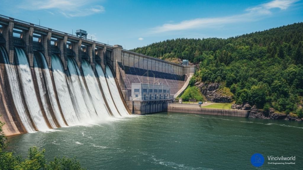
Dams are obstructions constructed across the water bodies to control the water flow and water levels. Dams serve as a water source for human consumption, irrigation purpose, and power generation. They also help prevent floods when there is a sudden discharge of floodwater. The water that impounds in the dams is also used for recreation purposes and industrial uses. They are mostly made up of rock fill or earthen.
- What are dams?
- Benefits of dam
- Site selection of dams.
- Advantages of dams
- Disadvantages of Dams
- Key Takeaways
- Conclusion
What are dams?
The dams are barriers built to restrict and manage the natural flow of rivers, waterways, or streams for human needs. A dam may be a natural one or artificial. They help to confine water and reduces the water rise and flood problems. Dams retain water by forming a reservoir behind the structure. They got an Upstream side and Down stream side. The place where water is collected is called the Upstream side. The water impounded is used as storage and is called Reservoir.

Also read : Type of Dams – 3 main classification criteria explained
Benefits of dam
The dams provide a range of environmental, economic and social benefits
One of the most important benefits of dams is water storage. The stored water is used for drinking, cleaning, bathing, gardening, irrigation purposes, industrial purposes.
The large dams and reservoirs serve as recreational spots for fishing and boating purposes. Dams play a major role in preventing damages due to floods by collecting and storing excess water during rains and are released as and when required.
The dam is the main source of providing water for irrigation purposes in areas where rain and water are scarce.
Also read : Methods of irrigation – 3 methods full guide
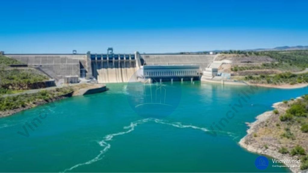
Site selection of dams.
The dam is a massive and strategic structure and needs a perfect site selection before proceeding with construction.Site selection of dams involves assessing factors like geology, river flow, and environmental impact. These factors ensure structural stability and reduce ecological disruption. The right site selection for dams minimizes risks such as flooding and maintenance issues. Soil type, valley shape, and climate also play a key role in site viability.
- Topography -Making maximum use of the available volume of water is the main objective of a dam. The slope of the area, groundwater table, contour, weather condition, etc is other factors for dam site selection. The bed level at the dam site should preferably be higher than that of the river basin. This is for reducing the dam height and facilitating the drainage of water.
- Foundation – The foundation should bear the whole weight and pressure of the dam. It should be permeable, thick, and should have adequate strength.
- Economic criteria – This includes the construction and maintenance cost of the dam. The land value, cost of construction materials and construction time, etc. to be taken into account while selecting a dam site. Quality construction materials required for dam construction have to be available near the proposed location. Always opt for a small length dam with maximum water holding capacity for economising the project.
- Height of Dam – The height of the dam should be economical, and should store the maximum amount of water.
- Earthquake zone – The dam site should not be an earthquake zone. It may cause a collapse of the dam and losses.
- Material availability – Materials like rock, aggregate, soil, filler, etc. should be available near the site.
- Climate condition – The climate of the site should be bearable, possibilities of landslides should not occur.
- Spillway site: A suitable location for the spillway should be available in the nearby vicinity of the dam.
- The dam site should be easily accessible and economically connected to nearby areas. Area required for establishments and labour camps of construction group shall be available nearby in a safe zone.
- Environmental issues should be taken into consideration while selecting the dam site.

Advantages of dams
- Water storage : Dams are one of the major sources of water for domestic uses. These uses include cooking, cleaning, bathing, washing, drinking water, and gardening. They also provide water for agricultural and industrial purposes. The water is supplied through the canal or with the help of a pipe system from the dam.
- Irrigation – The water from the dams is diverted through canals. This water reaches fields where the water level is low. It is used for irrigation purposes.
- Hydroelectric power – The water stored in the dam is passed through turbines for hydroelectric power generation.
- Flood prevention – The water level of river, streams, etc are maintained by constructing dams across it. This prevents the loss and damages from unexpected floods.
- Recreation – The water stored in the dam is used for fishing, boating, and other recreational activities.
- Debris control – Dam also provides the retention of hazardous material and protects the environment.
Disadvantages of Dams
- Groundwater table – Stagnation of water in the dams alters the groundwater table.
- Ecosystem – The dams prevent the fish migration and help in the breeding of mosquito which affects the ecosystem.
- Water temperature – The aquatic temperature is varied by the dams, which causes a serious problem for aquatic lives.
- Greenhouse effect – The reservoirs emit greenhouse gases which leads to global warming.
- Rehabilitation – The discharge of water from the river affects the peoples living in the downstream area.
Key Takeaways
- Importance of Site Selection: Effective dam construction relies on careful site selection, considering hydrological and geological factors.
- Advantages of Dams:
- Provide water storage for irrigation and drinking.
- Offer flood control and management.
- Generate hydroelectric power, contributing to energy supply.
- Disadvantages of Dams:
- Can lead to environmental degradation and loss of biodiversity.
- May displace local communities and affect livelihoods.
- Alter aquatic ecosystems and sediment transport.
- Mitigation Strategies: Comprehensive environmental assessments and proper planning can help address negative impacts.
- Stakeholder Engagement: Involving local communities in the decision-making process enhances public acceptance and addresses concerns.
- Balanced Decision-Making: Understanding both advantages and disadvantages of dams is vital for informed policy and engineering choices.
- Sustainable Practices: Prioritizing sustainability in dam projects ensures long-term benefits for both society and the environment.
Conclusion
The process of dams site selection requires careful consideration of various factors. It involves balancing the advantages of water management and energy generation. These must be weighed against the disadvantages related to environmental and social impacts. By prioritizing sustainable practices and involving communities in decision-making, the negative consequences of dams can be minimized. Policymakers and engineers must adopt an integrated approach to site selection for dams. This approach ensures the benefits provided align with ecological preservation. It also supports social equity. A well-informed strategy will help develop dams that positively impact society. It will also protect natural resources for future generations.